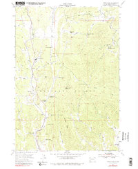
1955 Map of Cicero Peak
USGS Topo · Published 1979About this map
Cicero Peak and its surrounding ridge lines dominate this mid-century view of the southern Black Hills National Forest, where high-altitude ranching and mineral extraction defined the local economy. The Chicago Burlington and Quincy railroad cuts through the western valleys, serving the community of Sanator and the adjacent State Sanatorium. This era shows a landscape transitioning from pioneer ranching to more formal institutional and recreational uses, with family-named holdings like the Sutherland Ranch and McCurran Ranch appearing alongside the Lake of the Pines.
Find a feature on this map
40 named features on this map. Tap any name to fly to it.
Don’t see what you’re looking for? This feature index may not catch every label — zoom into the map to look around manually.
Map Details
Editions of this 1955 Cicero Peak Map
3 editions found
Other maps of this area

1894 · Hermosa
USGS Topo · 1:125,000

1896 · Harney Peak
USGS Topo · 1:125,000

1901 · Hermosa
USGS Topo · 1:125,000

1901 · Harney Peak
USGS Topo · 1:125,000

1954 · Iron Mountain
USGS Topo · 1:24,000

1954 · Fourmile
USGS Topo · 1:24,000

1954 · Custer
USGS Topo · 1:24,000

1954 · Berne
USGS Topo · 1:24,000

1954 · Mount Rushmore
USGS Topo · 1:62,500

1955 · Mt. Coolidge
USGS Topo · 1:24,000