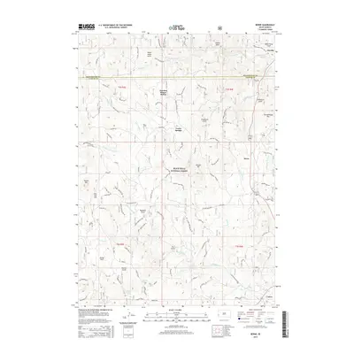
2015 Map of Berne
USGS Topo · Published 2015About this map
Black Hills National Forest land dominates this landscape, where the headwaters of several major drainages carve through the granite and limestone of the Southern Hills. The area serves as a significant drainage divide, with the N Fork French Cr and Middle Fork French Cr flowing westward toward the city of Custer, while Spring Cr and Tenderfoot Cr carry water toward the northeast. The settlement pattern follows the established corridors of Highway 16/385, connecting historic railroad and stage points like Oreville and Berne.
Find a feature on this map
49 named features on this map. Tap any name to fly to it.
Don’t see what you’re looking for? This feature index may not catch every label — zoom into the map to look around manually.
Map Details
Editions of this 2015 Berne Map
This is the sole edition of this map. No revisions or reprints were ever made.
Other maps of this area

1896 · Harney Peak
USGS Topo · 1:125,000

1901 · Harney Peak
USGS Topo · 1:125,000

1954 · Fourmile
USGS Topo · 1:24,000

1954 · Custer
USGS Topo · 1:24,000

1954 · Hill City
USGS Topo · 1:24,000

1954 · Berne
USGS Topo · 1:24,000

1955 · Jewel Cave
USGS Topo · 1:24,000

1955 · Signal Hill
USGS Topo · 1:24,000
1955 · Cicero Peak
USGS Topo · 1:24,000

1955 · Hot Springs
USGS Topo · 1:250,000