
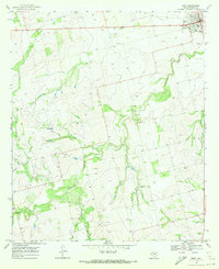
1969 Map of Bernecker
USGS Topo · Published 1972About this map
Claytonville and the small siding of Bernecker anchor this survey of the Texas landscape where Fisher and Nolan Counties meet. During the late 1960s, the region was defined by a mix of cattle ranching and industrial infrastructure, evidenced by the Eighteen Ranch and a prominent Refinery near the northern boundary. The Atchison Topeka and Santa Fe railroad cuts a diagonal path across the terrain, crossing Linn Creek and Live Oak Creek as it moves toward the horizon.
Find a feature on this map
17 named features on this map. Tap any name to fly to it.
Don’t see what you’re looking for? This feature index may not catch every label — zoom into the map to look around manually.
Map Details
Editions of this 1969 Bernecker Map
This is the sole edition of this map. No revisions or reprints were ever made.
Other maps of this area

1893 · Roby
USGS Topo · 1:125,000

1893 · Sweetwater
USGS Topo · 1:125,000

1954 · Big Spring
USGS Topo · 1:250,000

1958 · Big Spring
USGS Topo · 1:250,000

1969 · Busby
USGS Topo · 1:24,000

1969 · Bull Creek
USGS Topo · 1:24,000

1969 · Inadale NW
USGS Topo · 1:24,000

1969 · Loraine
USGS Topo · 1:24,000

1969 · Roscoe
USGS Topo · 1:24,000
1969 · Roby
USGS Topo · 1:24,000