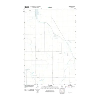
2010 Map of Berner
USGS Topo · Published 2010About this map
The unincorporated settlement of Berner anchors this northwestern Minnesota landscape, positioned at the junction of several county routes that define the local grid. This 2010 survey highlights a region shaped by its water systems, notably where the Clearwater River winds through the northern and eastern sections, joined by tributaries like Butcher Knife Creek and the meandering Ruffy Brook. The map reveals a high concentration of small, family-named water bodies in the southwest, including Wilmoe Lake, Tatge Lake, and Larson Lake, which likely reflect the area's homesteading history. For those tracing family roots or local history, the placement of the United Lutheran Cemetery near Berner and the Greenwood Cemetery to the south provides essential landmarks of the community's social geography. To the northwest, the Big Swamp Dam indicates early 21st-century water management within the broader wetland environment.
Find a feature on this map
30 named features on this map. Tap any name to fly to it.
Don’t see what you’re looking for? This feature index may not catch every label — zoom into the map to look around manually.
Map Details
Editions of this 2010 Berner Map
This is the sole edition of this map. No revisions or reprints were ever made.
Other maps of this area

1919 · Fosston
USGS Topo · 1:62,500

1919 · Churnes
USGS Topo · 1:62,500

1919 · Winsor
USGS Topo · 1:62,500

1943 · Bagley
USGS Topo · 1:62,500

1954 · Bemidji
USGS Topo · 1:250,000

1957 · Bemidji
USGS Topo · 1:250,000

1958 · Bemidji
USGS Topo · 1:250,000

1969 · Clearbrook
USGS Topo · 1:24,000

1969 · Leonard
USGS Topo · 1:24,000

1969 · Gonvick
USGS Topo · 1:24,000