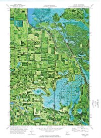
1972 Map of Berner
USGS Topo · Published 1976About this map
Red Lake Indian Reservation lands dominate the northeastern portion of this landscape, where the Clearwater River carves a winding path through the wetland-rich terrain. The area is defined by its intensive hydraulic management, evidenced by multiple Pumping Stations that regulate water levels across the low-lying glacial plains. The small settlement of Berner serves as a central point for the local community, which is divided into townships like Windsor, Greenwood, and Hangaard.
Find a feature on this map
22 named features on this map. Tap any name to fly to it.
Don’t see what you’re looking for? This feature index may not catch every label — zoom into the map to look around manually.
Map Details
Editions of this 1972 Berner Map
This is the sole edition of this map. No revisions or reprints were ever made.
Other maps of this area

1919 · Fosston
USGS Topo · 1:62,500

1919 · Churnes
USGS Topo · 1:62,500

1919 · Winsor
USGS Topo · 1:62,500

1943 · Bagley
USGS Topo · 1:62,500

1954 · Bemidji
USGS Topo · 1:250,000

1957 · Bemidji
USGS Topo · 1:250,000

1958 · Bemidji
USGS Topo · 1:250,000

1969 · Clearbrook
USGS Topo · 1:24,000

1969 · Leonard
USGS Topo · 1:24,000

1969 · Gonvick
USGS Topo · 1:24,000