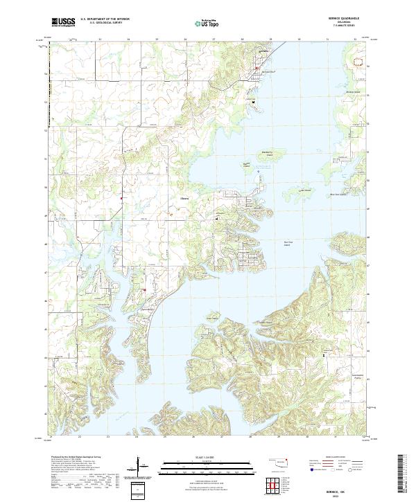
2022 Map of Bernice
USGS Topo · Published 2022About this map
Bernice and the northeastern reaches of the Grand Lake O' The Cherokees define this section of the Neosho River valley. The map details a landscape shaped by the impoundment of the river, where former hills and ridges now appear as a complex archipelago, including Monkey Island, Rabbit Island, and Blackberry Island. The topography transitions from the aquatic margins of Bernice Point to the elevated terrain of Sweetwater Prairie and the sharp relief of Tynon Bluffs.
Find a feature on this map
109 named features on this map. Tap any name to fly to it.
Don’t see what you’re looking for? This feature index may not catch every label — zoom into the map to look around manually.
Map Details
Editions of this 2022 Bernice Map
This is the sole edition of this map. No revisions or reprints were ever made.
Other maps of this area

1896 · Pryor
USGS Topo · 1:125,000

1899 · Siloam Springs
USGS Topo · 1:125,000

1901 · Vinita
USGS Topo · 1:125,000

1901 · Pryor
USGS Topo · 1:125,000

1903 · Siloam Springs
USGS Topo · 1:125,000

1904 · Siloam Springs
USGS Topo · 1:125,000

1907 · Wyandotte
USGS Topo · 1:125,000

1909 · Wyandotte
USGS Topo · 1:125,000

1913 · Vinita
USGS Topo · 1:125,000

1954 · Tulsa
USGS Topo · 1:250,000