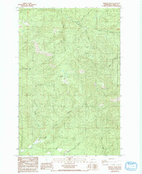
1985 Map of Bernier Creek
USGS Topo · Published 1993About this map
The Snoqualmie National Forest boundary defines the eastern edge of this landscape, where the headwaters of several major Lewis County drainages converge. The drainage system is particularly dense, featuring the upper reaches of the Skookumchuck River and the complex forks of the Newaukum, including the North Fork Newaukum River and the South Fork Newaukum River. This 1980s terrain is characterized by steep timberland and resource management, evidenced by several Borrow Pits and a network of unimproved roads and trails designed for forest access.
Find a feature on this map
16 named features on this map. Tap any name to fly to it.
Don’t see what you’re looking for? This feature index may not catch every label — zoom into the map to look around manually.
Map Details
Editions of this 1985 Bernier Creek Map
2 editions found
Other maps of this area

1916 · Chehalis
USGS Topo · 1:125,000

1937 · Eatonville
USGS Topo · 1:125,000

1941 · Tanwax Lake
USGS Topo · 1:62,500

1943 · Willapa
USGS Topo · 1:62,500

1944 · Yelm
USGS Topo · 1:62,500

1944 · Ohop Valley
USGS Topo · 1:62,500

1949 · Ohop Valley
USGS Topo · 1:62,500

1949 · Yelm
USGS Topo · 1:62,500

1953 · Hoquiam
USGS Topo · 1:250,000

1954 · Onalaska
USGS Topo · 1:62,500