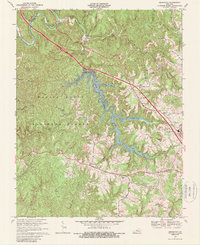
1969 Map of Bernstadt
USGS Topo · Published 1989About this map
Wood Creek Lake dominates the central landscape of this Laurel County survey, its dendritic fingers reaching deep into the ridges of the Daniel Boone National Forest. The map documents a period of transition where traditional ridge-and-hollow settlements like Bernstadt and Hare persist alongside newer infrastructure, such as the Filtration Plant and Weighing Station. The rugged topography is etched with small-scale industrial activity, including several scattered strip mines and local extraction points near Powder Mill Creek.
Find a feature on this map
46 named features on this map. Tap any name to fly to it.
Don’t see what you’re looking for? This feature index may not catch every label — zoom into the map to look around manually.
Map Details
Editions of this 1969 Bernstadt Map
3 editions found
Other maps of this area

1893 · London
USGS Topo · 1:125,000

1897 · London
USGS Topo · 1:125,000

1952 · Lily
USGS Topo · 1:24,000

1952 · London SW
USGS Topo · 1:24,000

1952 · Billows
USGS Topo · 1:24,000

1952 · Ano
USGS Topo · 1:24,000

1952 · Bernstadt
USGS Topo · 1:24,000

1952 · London
USGS Topo · 1:24,000

1953 · Livingston
USGS Topo · 1:24,000

1953 · Mount Vernon
USGS Topo · 1:24,000