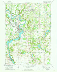
1971 Map of Berrien Springs
USGS Topo · Published 1973About this map
The St Joseph River defines the landscape of this corner of Michigan, winding through the heart of the region and broadening into Lake Chapin south of Berrien Springs. By the early 1970s, this area shows a distinctive blend of educational expansion and agricultural tradition, anchored by the campus of Andrews University and the surrounding rural townships. The river's path is marked by features like Pardee Island and surrounded by pockets of community activity, from the residential clusters in Eau Claire and Berrien Center to the lakeside camps such as Camp Oronoko and Michiana Camp.
Find a feature on this map
55 named features on this map. Tap any name to fly to it.
Don’t see what you’re looking for? This feature index may not catch every label — zoom into the map to look around manually.
Map Details
Editions of this 1971 Berrien Springs Map
2 editions found
Other maps of this area

1927 · Niles
USGS Topo · 1:62,500

1927 · Hartford
USGS Topo · 1:62,500

1927 · Benton Harbor
USGS Topo · 1:62,500

1930 · Benton Harbor
USGS Topo · 1:62,500

1930 · Niles
USGS Topo · 1:62,500

1931 · Hartford
USGS Topo · 1:62,500

1943 · Niles
USGS Topo · 1:62,500

1945 · Cassopolis
USGS Topo · 1:62,500

1947 · Cassopolis
USGS Topo · 1:62,500

1953 · Chicago
USGS Topo · 1:250,000