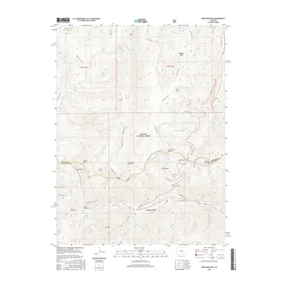
2016 Map of Berthoud Pass
USGS Topo · Published 2016About this map
Berthoud Pass serves as the central high-altitude crossing on this mid-2010s survey, marking a critical divide between the Fraser River and the W Fork Clear Cr drainages. This portion of the Arapaho National Forest is defined by its recreation and infrastructure, featuring the extensive Winter Park Ski Area and Mary Jane Ski Area in the northeastern quadrant. The map records the intricate network of alpine trails including the Continental Divide National Scenic Trail and the Mount Nystrom Trail. Subterranean engineering is also visible through the Vasquez Tunnel and the August P Gumlick Tunnel, which facilitate water diversion across the Continental Divide. From the peaks of Vasquez Peak to the settlement at Berthoud Falls, the map documents a landscape where historic transit routes like Old Berthoud Pass meet modern industrial and recreational demands.
Find a feature on this map
51 named features on this map. Tap any name to fly to it.
Don’t see what you’re looking for? This feature index may not catch every label — zoom into the map to look around manually.
Map Details
Editions of this 2016 Berthoud Pass Map
This is the sole edition of this map. No revisions or reprints were ever made.
Other maps of this area

1903 · Georgetown
USGS Topo · 1:62,500

1905 · Central City
USGS Topo · 1:62,500

1905 · Georgetown
USGS Topo · 1:62,500

1910 · Central City
USGS Topo · 1:62,500

1912 · Central City
USGS Topo · 1:62,500

1924 · Montezuma
USGS Topo · 1:62,500

1924 · Fraser
USGS Topo · 1:62,500

1926 · Fraser
USGS Topo · 1:62,500

1926 · Montezuma
USGS Topo · 1:62,500

1933 · Montezuma
USGS Topo · 1:62,500