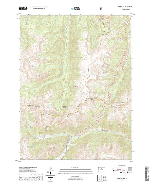
2022 Map of Berthoud Pass
USGS Topo · Published 2022About this map
Arapaho National Forest dominates the high-altitude landscape of this 2022 survey, straddling the boundary between Grand and Clear Creek counties. The Continental Divide cuts a winding path across the terrain, notably marked by Berthoud Pass and Vasquez Pass. This area is a critical junction for both recreation and infrastructure, featuring the extensive Winter Park Ski Area and the Mary Jane Ski Area with their specialized trails like Rainmaker Trl and Spicy Chicken Trl. Below the surface, the August P Gumlick Tunnel and Vasquez Tunnel represent significant engineering efforts to manage water resources across the divide, feeding into drainage systems like the Fraser River. The map also traces established routes including the Continental Divide National Scenic Trl and Woods Creek Road Trl, providing a look at how this mountain corridor is navigated by both modern travelers and hikers.
Find a feature on this map
57 named features on this map. Tap any name to fly to it.
Don’t see what you’re looking for? This feature index may not catch every label — zoom into the map to look around manually.
Map Details
Editions of this 2022 Berthoud Pass Map
This is the sole edition of this map. No revisions or reprints were ever made.
Other maps of this area

1903 · Georgetown
USGS Topo · 1:62,500

1905 · Central City
USGS Topo · 1:62,500

1905 · Georgetown
USGS Topo · 1:62,500

1910 · Central City
USGS Topo · 1:62,500

1912 · Central City
USGS Topo · 1:62,500

1924 · Montezuma
USGS Topo · 1:62,500

1924 · Fraser
USGS Topo · 1:62,500

1926 · Fraser
USGS Topo · 1:62,500

1926 · Montezuma
USGS Topo · 1:62,500

1933 · Montezuma
USGS Topo · 1:62,500