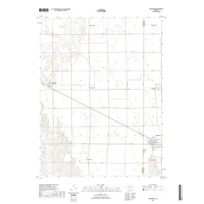
2017 Map of Bertrand
USGS Topo · Published 2017About this map
The agricultural plains of the Nebraska interior are captured here in a 2017 survey along the border of Gosper and Phelps Counties. The village of Bertrand anchors the southeastern corner of the sheet, where a dense grid of streets including Montrose Ave and School St suggests a well-established community. To the northwest, the smaller settlement of Smithfield sits near the intersection of W Platte St and Nebraska Ave.
Find a feature on this map
45 named features on this map. Tap any name to fly to it.
Don’t see what you’re looking for? This feature index may not catch every label — zoom into the map to look around manually.
Map Details
Editions of this 2017 Bertrand Map
This is the sole edition of this map. No revisions or reprints were ever made.
Other maps of this area

1896 · Lexington
USGS Topo · 1:125,000

1896 · Arapahoe
USGS Topo · 1:125,000

1898 · Arapahoe
USGS Topo · 1:125,000

1899 · Lexington
USGS Topo · 1:125,000

1955 · Grand Island
USGS Topo · 1:250,000

1957 · Grand Island
USGS Topo · 1:250,000

1958 · Grand Island
USGS Topo · 1:250,000
1962 · Overton
USGS Topo · 1:24,000

1962 · Bertrand NW
USGS Topo · 1:24,000
1970 · Loomis
USGS Topo · 1:24,000