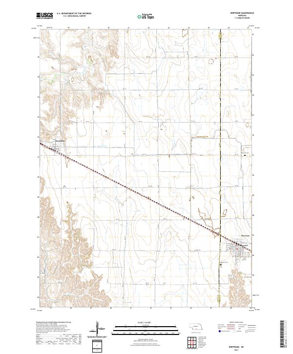
2021 Map of Bertrand
USGS Topo · Published 2021About this map
The village of Bertrand anchors the southeastern corner of this modern topographic survey, situated precisely where the border between Gosper County and Phelps County runs northward. The landscape reflects the highly organized agricultural grid typical of the Nebraska plains, with an extensive network of range roads such as RD 744 and RD 738 dissecting the terrain. The water management system is visible through Lateral E-65, which cuts across the central portion of the map, while Plum Creek meanders through the northwestern hills. In the north, the small settlement of Smithfield appears along the railroad corridor, serving as a secondary hub for the surrounding farmsteads. Local history is anchored by the presence of Highland Cemetery and Immanuel Cemetery, providing essential landmarks for genealogical research in this rural region.
Find a feature on this map
42 named features on this map. Tap any name to fly to it.
Don’t see what you’re looking for? This feature index may not catch every label — zoom into the map to look around manually.
Map Details
Editions of this 2021 Bertrand Map
This is the sole edition of this map. No revisions or reprints were ever made.
Other maps of this area

1896 · Lexington
USGS Topo · 1:125,000

1896 · Arapahoe
USGS Topo · 1:125,000

1898 · Arapahoe
USGS Topo · 1:125,000

1899 · Lexington
USGS Topo · 1:125,000

1955 · Grand Island
USGS Topo · 1:250,000

1957 · Grand Island
USGS Topo · 1:250,000

1958 · Grand Island
USGS Topo · 1:250,000
1962 · Overton
USGS Topo · 1:24,000

1962 · Bertrand NW
USGS Topo · 1:24,000
1970 · Loomis
USGS Topo · 1:24,000