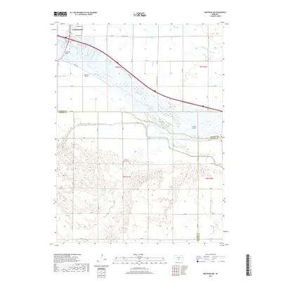
2017 Map of Bertrand NW
USGS Topo · Published 2017About this map
Lexington anchors the northern edge of this Platte Valley landscape, where the braided channels of the Platte River create a complex network of landforms like Danielson Island and Jeffreys Island. The transition from the river valley to the elevated bluffs in the south is marked by a sophisticated irrigation and water management system, including the Phelps County Canal, Berquist Lateral, and Beatty Ditch. These man-made features work alongside natural drainages such as Spring Cr and Plum Cr to support the region's agricultural economy.
Find a feature on this map
37 named features on this map. Tap any name to fly to it.
Don’t see what you’re looking for? This feature index may not catch every label — zoom into the map to look around manually.
Map Details
Editions of this 2017 Bertrand NW Map
This is the sole edition of this map. No revisions or reprints were ever made.
Other maps of this area

1896 · Lexington
USGS Topo · 1:125,000

1899 · Lexington
USGS Topo · 1:125,000

1955 · Grand Island
USGS Topo · 1:250,000

1957 · Grand Island
USGS Topo · 1:250,000

1958 · Grand Island
USGS Topo · 1:250,000

1962 · Lexington West
USGS Topo · 1:24,000

1962 · Lexington SE
USGS Topo · 1:24,000

1962 · Lexington East
USGS Topo · 1:24,000
1962 · Overton
USGS Topo · 1:24,000

1962 · Bertrand NW
USGS Topo · 1:24,000