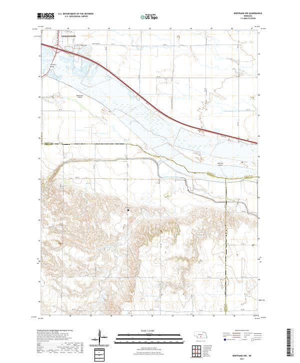
2021 Map of Bertrand NW
USGS Topo · Published 2021About this map
Lexington anchors the northern edge of this Nebraska landscape, where the Platte River braided channel system defines the boundary between Dawson, Gosper, and Phelps counties. Large river features like Danielson Island and Jeffreys Island highlight the shifting nature of this waterway, while the Lexington Bridge provides a vital link across the wide floodplain near the mouth of Plum Creek. South of the river, the terrain transitions into the managed water systems of the Nebraska plains, marked by the Phelps County Canal and Phillippi Reservoir. This 2021 survey illustrates the complex relationship between agricultural water management and the natural river course. Genealogists and local historians can locate the Robb Cem situated in the central hills, a point of permanence amidst the expansive network of county roads like Dr 751 and Rd 435.
Find a feature on this map
43 named features on this map. Tap any name to fly to it.
Don’t see what you’re looking for? This feature index may not catch every label — zoom into the map to look around manually.
Map Details
Editions of this 2021 Bertrand NW Map
This is the sole edition of this map. No revisions or reprints were ever made.
Other maps of this area

1896 · Lexington
USGS Topo · 1:125,000

1899 · Lexington
USGS Topo · 1:125,000

1955 · Grand Island
USGS Topo · 1:250,000

1957 · Grand Island
USGS Topo · 1:250,000

1958 · Grand Island
USGS Topo · 1:250,000

1962 · Lexington West
USGS Topo · 1:24,000

1962 · Lexington SE
USGS Topo · 1:24,000

1962 · Lexington East
USGS Topo · 1:24,000
1962 · Overton
USGS Topo · 1:24,000

1962 · Bertrand NW
USGS Topo · 1:24,000