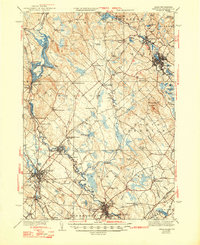
1944 Map of Berwick
USGS Topo · Published 1948About this map
Rochester and Sanford serve as the primary industrial and commercial anchors of this 1940s border region, where the Salmon Falls River and Mousam River defined the economic landscape of Maine and New Hampshire. The Boston And Maine railroad network is highly developed here, connecting smaller stops like Eastwood Sta and Rindgemere Sta to the textile and manufacturing hubs of the Piscataqua river system. The map captures the significant role of water power at the Great Falls Lower Hydro-Electric Plant in Somersworth, highlighting the transition from traditional milling to modern electrical generation.
Find a feature on this map
100 named features on this map. Tap any name to fly to it.
Don’t see what you’re looking for? This feature index may not catch every label — zoom into the map to look around manually.
Map Details
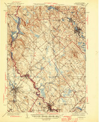
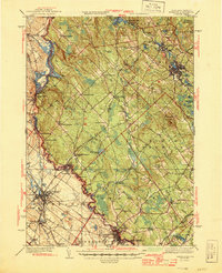
Editions of this 1944 Berwick Map
3 editions found
Other maps of this area

1891 · Berwick
USGS Topo · 1:62,500

1891 · Kennebunk
USGS Topo · 1:62,500

1891 · Buxton
USGS Topo · 1:62,500

1891 · Newfield
USGS Topo · 1:62,500

1892 · Buxton
USGS Topo · 1:62,500

1893 · Kennebunk
USGS Topo · 1:62,500

1893 · Dover
USGS Topo · 1:62,500

1893 · Berwick
USGS Topo · 1:62,500

1893 · York
USGS Topo · 1:62,500

1893 · Buxton
USGS Topo · 1:62,500