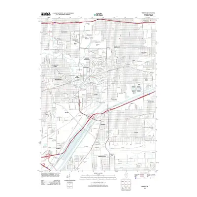
2012 Map of Berwyn
USGS Topo · Published 2012About this map
The Des Plaines River corridor serves as a central spine for this densely developed portion of Cook County, where industrial history and suburban expansion meet. The landscape is heavily marked by significant institutional and commemorative spaces, including the expansive Waldheim Cem, Woodlawn Cem, and Resurrection Cem. To the east, the aviation hub of Chicago Midway International Airport dominates the terrain, while the rail infrastructure of Hawthorne Yard reflects the area's deep-rooted logistics economy.
Find a feature on this map
104 named features on this map. Tap any name to fly to it.
Don’t see what you’re looking for? This feature index may not catch every label — zoom into the map to look around manually.
Map Details
Editions of this 2012 Berwyn Map
This is the sole edition of this map. No revisions or reprints were ever made.
Other maps of this area

1889 · Chicago
USGS Topo · 1:62,500

1890 · Des Plaines
USGS Topo · 1:62,500

1891 · Chicago
USGS Topo · 1:62,500

1891 · Riverside
USGS Topo · 1:62,500

1892 · Calumet
USGS Topo · 1:62,500

1893 · Calumet
USGS Topo · 1:62,500

1893 · Riverside
USGS Topo · 1:62,500

1894 · Des Plaines
USGS Topo · 1:62,500

1900 · Chicago
USGS Topo · 1:62,500

1900 · Des Plaines
USGS Topo · 1:62,500