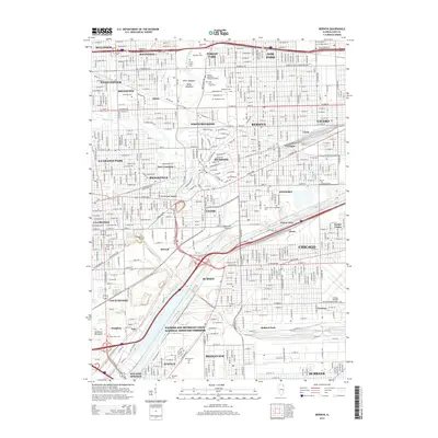
2015 Map of Berwyn
USGS Topo · Published 2015About this map
The Des Plaines River and Salt Creek create a natural corridor through this densely developed portion of Cook County, where industrial history meets significant memorial grounds. The landscape is defined by an extraordinary concentration of cemeteries, including Waldheim Cem, Forest Home Cem, and the Free Sons of Israel Cem, which reflect the region's diverse genealogical heritage. To the south, the Illinois and Michigan Canal National Heritage Corridor runs parallel to the river, marking the historic path of Midwestern commerce. Transportation and industry are prominent, with the Burlington Northern railroad bisecting residential neighborhoods and the massive footprint of the Chicago Midway International Airport occupying the southeastern corner. Open spaces like Miller Meadow and Plank Road Meadow provide a stark contrast to the nearby rail yards at Glenn and the industrial zones of Bedford Park.
Find a feature on this map
109 named features on this map. Tap any name to fly to it.
Don’t see what you’re looking for? This feature index may not catch every label — zoom into the map to look around manually.
Map Details
Editions of this 2015 Berwyn Map
This is the sole edition of this map. No revisions or reprints were ever made.
Other maps of this area

1889 · Chicago
USGS Topo · 1:62,500

1890 · Des Plaines
USGS Topo · 1:62,500

1891 · Chicago
USGS Topo · 1:62,500

1891 · Riverside
USGS Topo · 1:62,500

1892 · Calumet
USGS Topo · 1:62,500

1893 · Calumet
USGS Topo · 1:62,500

1893 · Riverside
USGS Topo · 1:62,500

1894 · Des Plaines
USGS Topo · 1:62,500

1900 · Chicago
USGS Topo · 1:62,500

1900 · Des Plaines
USGS Topo · 1:62,500