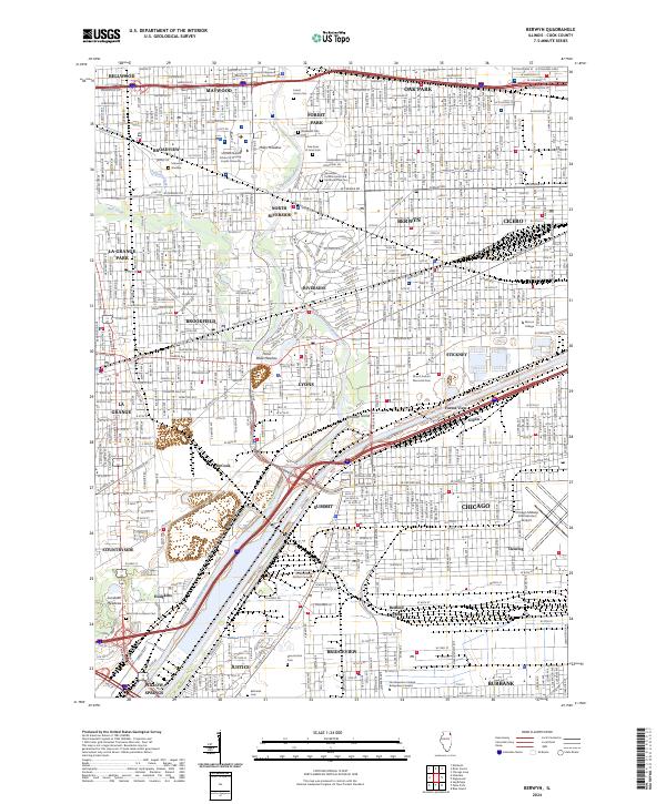
2024 Map of Berwyn
USGS Topo · Published 2024About this map
The Des Plaines River corridor serves as the central spine for this densely developed suburban landscape, which includes major communities such as Berwyn, Cicero, and Oak Park. The map reveals a high concentration of memorial and historical sites along the river's path, notably the sprawling grounds of Forest Home Cem and the adjacent Waldheim Cem. These large tracts of green space contrast sharply with the grid-patterned residential neighborhoods and the industrial and transportation infrastructure that defines the region.
Find a feature on this map
59 named features on this map. Tap any name to fly to it.
Don’t see what you’re looking for? This feature index may not catch every label — zoom into the map to look around manually.
Map Details
Editions of this 2024 Berwyn Map
This is the sole edition of this map. No revisions or reprints were ever made.
Other maps of this area

1889 · Chicago
USGS Topo · 1:62,500

1890 · Des Plaines
USGS Topo · 1:62,500

1891 · Chicago
USGS Topo · 1:62,500

1891 · Riverside
USGS Topo · 1:62,500

1892 · Calumet
USGS Topo · 1:62,500

1893 · Calumet
USGS Topo · 1:62,500

1893 · Riverside
USGS Topo · 1:62,500

1894 · Des Plaines
USGS Topo · 1:62,500

1900 · Chicago
USGS Topo · 1:62,500

1900 · Des Plaines
USGS Topo · 1:62,500