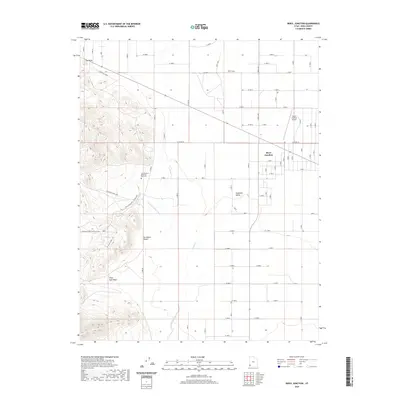
2020 Map of Beryl Junction
USGS Topo · Published 2020About this map
Beryl Junction serves as the central hub of this Iron County landscape, where the flat agricultural expanses of the Escalante Valley meet the rugged terrain of the Escalante Desert. The map reveals an intricate grid of irrigation and industrial infrastructure, notably the Escalante Mine Canal and several access routes serving local mineral interests, such as the Escalante Mine - Silver Mine road. To the west, the topography rises sharply at The Point, overlooking the drainage patterns of Pinon Park Wash and Shoal Creek. This 2020 survey documents the modern layout of the community, including the Beryl Junction Airport and the John McGarry Memorial Park Cem, illustrating how water management and mining have shaped the settlement patterns in this arid corner of Utah.
Find a feature on this map
52 named features on this map. Tap any name to fly to it.
Don’t see what you’re looking for? This feature index may not catch every label — zoom into the map to look around manually.
Map Details
Editions of this 2020 Beryl Junction Map
This is the sole edition of this map. No revisions or reprints were ever made.
Other maps of this area

1885 · St. George
USGS Topo · 1:250,000

1891 · St. George
USGS Topo · 1:250,000

1953 · Cedar City
USGS Topo · 1:250,000

1958 · Cedar City
USGS Topo · 1:250,000

1962 · Cedar City
USGS Topo · 1:250,000
1972 · Yale Crossing
USGS Topo · 1:24,000
1972 · Pinto
USGS Topo · 1:24,000

1972 · Pinon Point
USGS Topo · 1:24,000
1972 · Beryl Junction
USGS Topo · 1:24,000
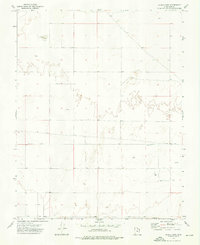
1972 · Clark Farm
USGS Topo · 1:24,000