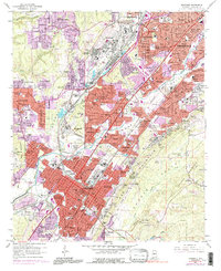
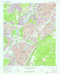
1959 Map of Bessemer
USGS Topo · Published 1991About this map
Red Mountain and the ridgelines of Shades Mountain define the industrial and residential corridors of Jefferson County during a period of significant mid-century expansion. The map details the complex rail infrastructure supporting the local economy, including the Louisville and Nashville Railroad, Southern Railway, and the Birmingham Southern Railroad, which weave through the iron-rich terrain. Established communities like Old Jonesboro and Bessemer Homestead sit alongside newer developments, while institutional landmarks such as Miles Memorial College and the DeBardeleben Armory serve as anchors for the local population.
Find a feature on this map
207 named features on this map. Tap any name to fly to it.
Don’t see what you’re looking for? This feature index may not catch every label — zoom into the map to look around manually.
Map Details
Editions of this 1959 Bessemer Map
5 editions found
Other maps of this area

1889 · Birmingham
USGS Topo · 1:125,000

1890 · Bessemer
USGS Topo · 1:125,000

1892 · Birmingham
USGS Topo · 1:125,000

1892 · Bessemer
USGS Topo · 1:125,000

1893 · Jasper
USGS Topo · 1:125,000

1895 · Birmingham
USGS Topo · 1:125,000

1899 · Brookwood
USGS Topo · 1:125,000

1904 · Birmingham Coal District
USGS Topo · 1:62,500

1905 · Bessemer Iron District
USGS Topo · 1:62,500

1906 · Birmingham Special
USGS Topo · 1:62,500