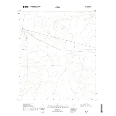
2019 Map of Best
USGS Topo · Published 2019About this map
Best sits at the northern edge of this West Texas landscape, a location defined by its history in the Reagan County oil fields. This 2019 survey documents the modern road network that still follows the paths laid out during the region's industrial development, including the prominent Texon Rd and Santa Rita Rd. These thoroughfares, along with local routes like Lone Wolf Rd and Golf Course Rd, crisscross a terrain shaped by wide drainage patterns.
Find a feature on this map
14 named features on this map. Tap any name to fly to it.
Don’t see what you’re looking for? This feature index may not catch every label — zoom into the map to look around manually.
Map Details
Editions of this 2019 Best Map
This is the sole edition of this map. No revisions or reprints were ever made.
Other maps of this area

1920 · Big Lake
USGS Topo · 1:62,500

1922 · Big Lake
USGS Topo · 1:62,500

1928 · Rankin
USGS Topo · 1:125,000

1954 · San Angelo
USGS Topo · 1:250,000

1958 · San Angelo
USGS Topo · 1:250,000

1965 · San Angelo
USGS Topo · 1:250,000
1970 · Texon SE
USGS Topo · 1:24,000

1970 · Garrison Draw
USGS Topo · 1:24,000

1970 · Gardener Draw
USGS Topo · 1:24,000
1970 · Divide Draw
USGS Topo · 1:24,000