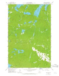
1960 Map of Beth Lake
USGS Topo · Published 1966About this map
Glacial lakes and dense woodlands dominate this 1960s landscape within the Superior National Forest and the Minnesota State Forest. The map detail reveals an intricate network of waterways essential to the region's recreation and timber history, centered on Beth Lake and the expansive Alton Lake. In the northeast, the Sawbill Campground sits at the edge of Sawbill Lake, serving as a primary entry point for the wilderness interior. The hydrology of the area is defined by numerous smaller bodies of water like Grace Lake and Phoebe Lake, connected by minor drainages such as Hog Creek and Timber Creek. This survey captures the terrain before modern motorized restrictions were fully established, documenting the primitive road access near the Temperance River and the boundary line between the national and state forest lands.
Find a feature on this map
31 named features on this map. Tap any name to fly to it.
Don’t see what you’re looking for? This feature index may not catch every label — zoom into the map to look around manually.
Map Details
Editions of this 1960 Beth Lake Map
3 editions found
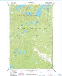
Other maps of this area

1954 · Two Harbors
USGS Topo · 1:250,000

1955 · Tofte
USGS Topo · 1:62,500

1955 · Cramer
USGS Topo · 1:62,500

1957 · Two Harbors
USGS Topo · 1:250,000

1958 · Two Harbors
USGS Topo · 1:250,000

1960 · Lake Polly
USGS Topo · 1:24,000

1960 · Kawishiwi Lake
USGS Topo · 1:24,000

1960 · Sawbill Camp
USGS Topo · 1:24,000

1960 · Beth Lake
USGS Topo · 1:24,000
1960 · Cherokee Lake
USGS Topo · 1:24,000