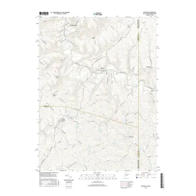
2016 Map of Bethany
USGS Topo · Published 2016About this map
Bethany Coll and W Liberty Univ anchor the local geography of this Appalachian borderland, where the West Virginia Panhandle meets Pennsylvania. The terrain is defined by prominent high ground such as McAdoo Ridge and Apple Pie Ridge, with deep drainages like Buffalo Creek carving through the landscape. This 2016 survey documents the enduring layout of historic settlements including Bethany, West Liberty, and Potomac. Local history is preserved in numerous family and community burial grounds, such as Lower Buffalo Cem, West Liberty Cem, and Cox Cem. Significant landmarks like the Donegal Bridge and numerous named springs, including Leo Miller Spring and Harden Spring, illustrate the intersection of human infrastructure and the natural water network in Brooke, Ohio, and Washington counties.
Find a feature on this map
133 named features on this map. Tap any name to fly to it.
Don’t see what you’re looking for? This feature index may not catch every label — zoom into the map to look around manually.
Map Details
Editions of this 2016 Bethany Map
This is the sole edition of this map. No revisions or reprints were ever made.
Other maps of this area

1902 · Wheeling
USGS Topo · 1:62,500

1904 · Steubenville
USGS Topo · 1:62,500

1904 · Burgettstown
USGS Topo · 1:62,500

1906 · Burgettstown
USGS Topo · 1:62,500

1907 · Claysville
USGS Topo · 1:62,500

1935 · Wheeling
USGS Topo · 1:62,500

1935 · Steubenville
USGS Topo · 1:62,500

1942 · Wheeling
USGS Topo · 1:62,500

1942 · Steubenville
USGS Topo · 1:62,500

1951 · Canton
USGS Topo · 1:250,000