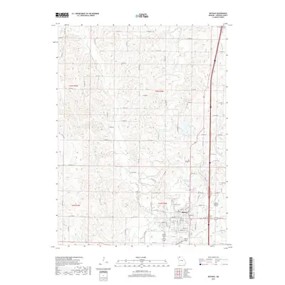
2017 Map of Bethany
USGS Topo · Published 2017About this map
Bethany serves as the focal point of this Harrison County landscape, where the confluence of several water systems defines the local geography. The city is positioned near the junction of Big Cr and its various tributaries, including W Fork Big Cr and E Fork Big Cr. This intricate drainage pattern is further modified by local engineering, seen in the Old Bethany City Lake and the larger New City Lake to the north. These reservoirs suggest the historical importance of water management for the growing community. Genealogists will find several small burial sites scattered across the rural sections, such as Russ Cem, Phillebaum Cem, and Dale Cem. The presence of the Bethany Memorial Airport on the eastern edge of the city illustrates the modern transition of this agricultural hub, while the dense grid of local roads like Miller St and Vandivert St provides a detailed view of the town's residential core.
Find a feature on this map
53 named features on this map. Tap any name to fly to it.
Don’t see what you’re looking for? This feature index may not catch every label — zoom into the map to look around manually.
Map Details
Editions of this 2017 Bethany Map
This is the sole edition of this map. No revisions or reprints were ever made.
Other maps of this area

1925 · Pattonsburg
USGS Topo · 1:62,500

1925 · Gilman
USGS Topo · 1:62,500

1944 · Pattonsburg
USGS Topo · 1:62,500

1946 · Gilman
USGS Topo · 1:48,000

1946 · Pattonsburg
USGS Topo · 1:48,000

1947 · Blythedale
USGS Topo · 1:62,500

1948 · Gilman
USGS Topo · 1:62,500

1948 · Bethany
USGS Topo · 1:62,500

1948 · Pattonsburg
USGS Topo · 1:62,500

1954 · Centerville
USGS Topo · 1:250,000