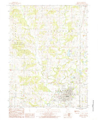
1984 Map of Bethany
USGS Topo · Published 1985About this map
The city of Bethany serves as the focal point of this Harrison County survey, capturing the community's layout in the early 1980s. The landscape is defined by the convergence of several waterways, including Big Creek and the West Fork, which wind through the terrain alongside Little Creek and Long Branch. This area reflects a traditional North Missouri agricultural and residential pattern, with the concentrated street grid of the town transitioning into open land marked by intermittent Cem sites. A notable piece of local infrastructure from this era is the Sewage Disposal Plant located just south of the main settlement. The map provides a clear view of the rural-urban interface before late-twentieth-century expansions altered the local topography.
Find a feature on this map
7 named features on this map. Tap any name to fly to it.
Don’t see what you’re looking for? This feature index may not catch every label — zoom into the map to look around manually.
Map Details
Editions of this 1984 Bethany Map
This is the sole edition of this map. No revisions or reprints were ever made.
Other maps of this area

1925 · Pattonsburg
USGS Topo · 1:62,500

1925 · Gilman
USGS Topo · 1:62,500

1944 · Pattonsburg
USGS Topo · 1:62,500

1946 · Gilman
USGS Topo · 1:48,000

1946 · Pattonsburg
USGS Topo · 1:48,000

1947 · Blythedale
USGS Topo · 1:62,500

1948 · Gilman
USGS Topo · 1:62,500

1948 · Bethany
USGS Topo · 1:62,500

1948 · Pattonsburg
USGS Topo · 1:62,500

1954 · Centerville
USGS Topo · 1:250,000