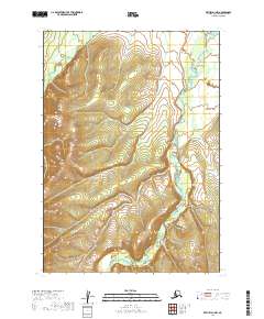
2019 Map of Bethel D-1 NW
USGS Topo · Published 2019About this map
Kipchuk River meanders through the eastern portion of this terrain, marking a drainage pattern that defines much of the remote interior landscape in the Bethel Census Area. The high elevations are carved by the Salmon River in the north and the headwaters of Pearl Cr to the west, creating a complex series of ridges and valleys within the Kuskokwim River watershed. This 2019 survey documents the hydrologic network within the public land survey system blocks of t11n r57w, t10n r56w, and surrounding townships. As a largely uninhabited region of the Alaskan bush, the map serves primarily as a record of natural topography and water flow, showing the winding paths of rivers before they join larger glacial systems downstream.
Find a feature on this map
9 named features on this map. Tap any name to fly to it.
Don’t see what you’re looking for? This feature index may not catch every label — zoom into the map to look around manually.
Map Details
Editions of this 2019 Bethel D-1 NW Map
This is the sole edition of this map. No revisions or reprints were ever made.
Other maps of this area

1947 · Russian Mission
USGS Topo · 1:250,000

1950 · Russian Mission
USGS Topo · 1:250,000

1950 · Bethel
USGS Topo · 1:250,000

1979 · Bethel D-2
USGS Topo · 1:63,360
1979 · Russian Mission A-1
USGS Topo · 1:63,360
1979 · Bethel D-1
USGS Topo · 1:63,360

1979 · Russian Mission A-2
USGS Topo · 1:63,360

1980 · Russian Mission
USGS Topo · 1:250,000

1980 · Bethel
USGS Topo · 1:250,000
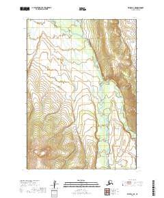
2019 · Bethel D-1 NE
USGS Topo · 1:25,000