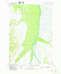
1979 Map of Russian Mission A-1
USGS Topo · Published 1979About this map
Braided river systems and seasonal pathways define this portion of the Alaska interior in the late 1970s. The Aniak River dominates the eastern half of the map, carving a wide, marshy corridor through the landscape where it meets tributaries like Chicken Creek and Timber Creek. Further west, the Salmon River and the Kipchuk River converge, highlighting the importance of these waterways as primary landmarks in a region largely devoid of permanent settlements. A lone Winter Trail cuts north-to-south across the center of the sheet, providing evidence of seasonal movement through the wetlands and river valleys. This survey, based on aerial photography from the early 1970s, captures the untouched character of the drainage basins between Swift Creek and the southern river forks before modern development patterns emerged.
Find a feature on this map
8 named features on this map. Tap any name to fly to it.
Don’t see what you’re looking for? This feature index may not catch every label — zoom into the map to look around manually.
Map Details
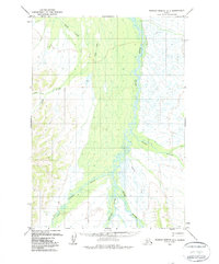
Editions of this 1979 Russian Mission A-1 Map
2 editions found
Other maps of this area

1947 · Russian Mission
USGS Topo · 1:250,000

1950 · Russian Mission
USGS Topo · 1:250,000

1950 · Sleetmute
USGS Topo · 1:250,000

1950 · Bethel
USGS Topo · 1:250,000

1950 · Taylor Mountains
USGS Topo · 1:250,000

1951 · Taylor Mountains
USGS Topo · 1:250,000

1952 · Russian Mission B-2
USGS Topo · 1:63,360
1952 · Russian Mission B-1
USGS Topo · 1:63,360

1954 · Sleetmute
USGS Topo · 1:250,000

1954 · Taylor Mountains
USGS Topo · 1:250,000