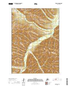
2019 Map of Bethel D-2 NE
USGS Topo · Published 2019About this map
The Salmon River drainage network dominates this remote portion of the Bethel Census Area, illustrating the complex hydrology of the Alaskan interior. This 2019 survey, derived from earlier National Hydrography and Elevation datasets, traces the intricate paths of Dominion Cr and Eureka Cr as they feed into the larger river system. The landscape is defined by tight contour intervals representing the high-relief terrain of the southwestern Alaskan wilderness. Named water bodies like Robin Cr, Pioneer Cr, and Pass Cr provide the primary geographic markers in a region otherwise characterized by its lack of road infrastructure or permanent settlements. The map's grid, encompassing parts of T10N R58W and surrounding townships, serves as a vital reference for understanding the natural drainage patterns and topographical boundaries of this unorganized territory.
Find a feature on this map
14 named features on this map. Tap any name to fly to it.
Don’t see what you’re looking for? This feature index may not catch every label — zoom into the map to look around manually.
Map Details
Editions of this 2019 Bethel D-2 NE Map
This is the sole edition of this map. No revisions or reprints were ever made.
Other maps of this area

1947 · Russian Mission
USGS Topo · 1:250,000

1950 · Russian Mission
USGS Topo · 1:250,000

1950 · Bethel
USGS Topo · 1:250,000

1979 · Bethel D-2
USGS Topo · 1:63,360
1979 · Russian Mission A-1
USGS Topo · 1:63,360
1979 · Bethel D-1
USGS Topo · 1:63,360

1979 · Russian Mission A-2
USGS Topo · 1:63,360

1980 · Russian Mission
USGS Topo · 1:250,000

1980 · Bethel
USGS Topo · 1:250,000
2019 · Bethel D-2 NW
USGS Topo · 1:25,000