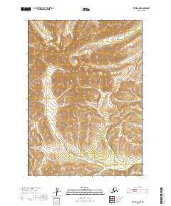
2019 Map of Bethel D-2 NW
USGS Topo · Published 2019About this map
Mt Plummer and Marvel Dome dominate this high-altitude interior landscape, which serves as a significant drainage divide within the Bethel region. The topography is defined by an intricate network of waterways carving through the high country, most notably the Fog River and Marvel Cr. The map reveals a complex system of tributary streams, including Eureka Cr, Robin Cr, and Eagle Cr, that flow outward from these central peaks. The absence of roads or permanent settlements underscores the remote wilderness character of this area in the early 21st century. Instead, the landscape is partitioned by the rigid lines of the Public Land Survey System, with township boundaries like t10n r59w and t11n r58w overlaying the natural contours of the mountain ridges and creek valleys.
Find a feature on this map
18 named features on this map. Tap any name to fly to it.
Don’t see what you’re looking for? This feature index may not catch every label — zoom into the map to look around manually.
Map Details
Editions of this 2019 Bethel D-2 NW Map
This is the sole edition of this map. No revisions or reprints were ever made.
Other maps of this area

1947 · Russian Mission
USGS Topo · 1:250,000

1950 · Russian Mission
USGS Topo · 1:250,000

1950 · Bethel
USGS Topo · 1:250,000

1954 · Russian Mission A-3
USGS Topo · 1:63,360

1954 · Bethel D-3
USGS Topo · 1:63,360

1979 · Bethel D-2
USGS Topo · 1:63,360

1979 · Russian Mission A-2
USGS Topo · 1:63,360

1980 · Russian Mission
USGS Topo · 1:250,000

1980 · Bethel
USGS Topo · 1:250,000
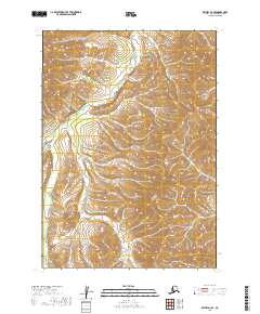
2019 · Bethel D-3 SE
USGS Topo · 1:25,000