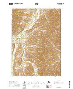
2019 Map of Bethel D-3 SE
USGS Topo · Published 2019About this map
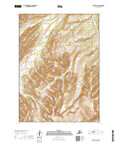
Kilbuck Mountains dominate the landscape of this region, which remains largely untouched by development as of 2019. This topography is defined by the high prominence of Fisher Dome, serving as a central drainage point for the surrounding watershed. Water flows through several distinct systems here, including the winding path of the Fog River in the western reaches, while the eastern slopes are carved by Fisher Cr. In the southwest corner, the headwaters of Karl Cr navigate the high-elevation terrain. This survey provides a precise look at the township and range boundaries including t9n r60w and t8n r61w, illustrating the complex drainage patterns and relief typical of this part of the Alaska interior.
Find a feature on this map
9 named features on this map. Tap any name to fly to it.
Don’t see what you’re looking for? This feature index may not catch every label — zoom into the map to look around manually.
Map Details
Editions of this 2019 Bethel D-3 SE Map
This is the sole edition of this map. No revisions or reprints were ever made.
Other maps of this area

1950 · Bethel
USGS Topo · 1:250,000

1954 · Bethel C-3
USGS Topo · 1:63,360

1954 · Bethel D-3
USGS Topo · 1:63,360

1979 · Bethel D-2
USGS Topo · 1:63,360

1979 · Bethel C-2
USGS Topo · 1:63,360

1980 · Bethel
USGS Topo · 1:250,000
2019 · Bethel D-3 NE
USGS Topo · 1:25,000
2019 · Bethel D-2 NW
USGS Topo · 1:25,000
2019 · Bethel C-3 NE
USGS Topo · 1:25,000
2019 · Bethel C-2 NW
USGS Topo · 1:25,000