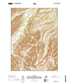
2019 Map of Bethel C-2 NW
USGS Topo · Published 2019About this map
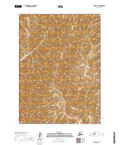
The Salmon River winds through the northwestern corner of this interior landscape in the Bethel Census Area, characterizing a terrain defined by steep ridges and narrow creek valleys. Several watercourses, including Dome Cr and Porcupine Cr, drain the high ground, illustrating the complex drainage patterns of the region's subarctic wilderness. The map details a transition of elevations where Loco Cr and Cripple Cr originate, showing the topography at the intersection of several townships including t8n r60w and t7n r59w. This 2019 survey documents a landscape devoid of permanent road infrastructure or settlements, reflecting the remote nature of the terrain east of the Kuskokwim River before any modern development altered these traditional drainage basins.
Find a feature on this map
11 named features on this map. Tap any name to fly to it.
Don’t see what you’re looking for? This feature index may not catch every label — zoom into the map to look around manually.
Map Details
Editions of this 2019 Bethel C-2 NW Map
This is the sole edition of this map. No revisions or reprints were ever made.
Other maps of this area

1950 · Bethel
USGS Topo · 1:250,000

1954 · Bethel C-3
USGS Topo · 1:63,360

1954 · Bethel D-3
USGS Topo · 1:63,360

1979 · Bethel D-2
USGS Topo · 1:63,360

1979 · Bethel C-2
USGS Topo · 1:63,360

1980 · Bethel
USGS Topo · 1:250,000
2019 · Bethel C-2 SE
USGS Topo · 1:25,000
2019 · Bethel C-2 NE
USGS Topo · 1:25,000
2019 · Bethel D-3 SE
USGS Topo · 1:25,000
2019 · Bethel C-3 SE
USGS Topo · 1:25,000