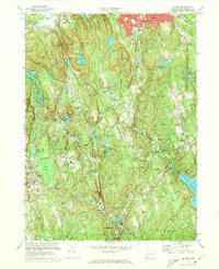
1970 Map of Bethel
USGS Topo · Published 1973About this map
Bethel and the surrounding Fairfield County townships appear here during a period of significant suburban development, yet the landscape remains defined by its complex hydrography and steep ridges. The central corridor is anchored by the Penn Central railroad, which tracks the Norwalk River through Branchville and Georgetown, while the Saugatuck River flows through the eastern hills toward the Saugatuck Reservoir. This survey captures the region just as the interstate era was reshaping local travel, though the older network of State Route 53 and State Route 58 still dictates the primary movement between Redding and the northern heights.
Find a feature on this map
108 named features on this map. Tap any name to fly to it.
Don’t see what you’re looking for? This feature index may not catch every label — zoom into the map to look around manually.
Map Details
Editions of this 1970 Bethel Map
3 editions found
Other maps of this area

1892 · Stamford
USGS Topo · 1:62,500

1892 · Danbury
USGS Topo · 1:62,500

1892 · Norwalk
USGS Topo · 1:62,500

1892 · Carmel
USGS Topo · 1:62,500

1893 · Carmel
USGS Topo · 1:62,500

1893 · Stamford
USGS Topo · 1:62,500

1893 · Norwalk
USGS Topo · 1:62,500

1894 · Carmel
USGS Topo · 1:62,500

1899 · Stamford
USGS Topo · 1:62,500

1915 · Danbury
USGS Topo · 1:62,500