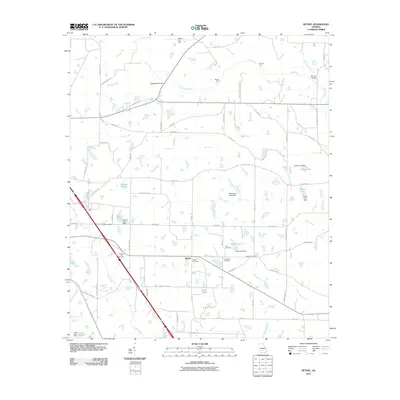
2011 Map of Bethel
USGS Topo · Published 2011About this map
The community of Bethel serves as the focal point of this Turner County landscape, where a network of rural roads connects several family-named landmarks and local burial grounds. Genealogists will find a high concentration of cemeteries in this area, including Pleasant Hill Cemetery, Bethel Cemetery, Ross Cemetery, Prospects Cemetery, and Clements Cemetery. The terrain is defined by the winding paths of Deep Creek and Hat Creek, which are crossed by historical infrastructure such as the Geoghagan Bridge and Shivers Bridge. In the northern section, Olsens Air Park and crossings at Gorday Ford and Rainey Ford reflect the traditional transit patterns of the region. Numerous small impoundments like Smith Pond, Wells Lake, and Busseys Pond dot the landscape, illustrating the local water management and agricultural practices of the early twenty-first century.
Find a feature on this map
73 named features on this map. Tap any name to fly to it.
Don’t see what you’re looking for? This feature index may not catch every label — zoom into the map to look around manually.
Map Details
Editions of this 2011 Bethel Map
This is the sole edition of this map. No revisions or reprints were ever made.
Other maps of this area

1953 · Waycross
USGS Topo · 1:250,000

1958 · Waycross
USGS Topo · 1:250,000

1973 · Sumner
USGS Topo · 1:24,000

1973 · Waterloo
USGS Topo · 1:24,000

1973 · Irwinville
USGS Topo · 1:24,000

1973 · Ashburn
USGS Topo · 1:24,000

1973 · Chula
USGS Topo · 1:24,000

1973 · Bethel
USGS Topo · 1:24,000

1974 · Rebecca
USGS Topo · 1:24,000

1974 · Amboy
USGS Topo · 1:24,000