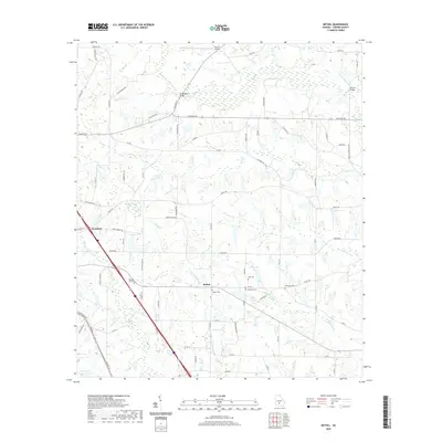
2020 Map of Bethel
USGS Topo · Published 2020About this map
Sycamore and the nearby settlement of Bethel anchor this Turner County landscape, defined by a complex network of creeks and small ponds. The geography is characterized by several historic burial grounds, including Pleasant Hill Cem and Clements Cem, which serve as vital touchstones for family historians tracing roots in the area. Waterways like Deep Creek, Sand Cr, and Little Sand Cr wind through the terrain, while landmarks such as Geoghagan Bridge and Shivers Bridge mark established crossing points over the various branches. The presence of Richter Airpark in the north and numerous local routes such as Sylvester Rd and Fire Tower Rd illustrate the modern transportation layout while preserving the names of early landmarks and families who settled this part of Georgia.
Find a feature on this map
85 named features on this map. Tap any name to fly to it.
Don’t see what you’re looking for? This feature index may not catch every label — zoom into the map to look around manually.
Map Details
Editions of this 2020 Bethel Map
This is the sole edition of this map. No revisions or reprints were ever made.
Other maps of this area

1953 · Waycross
USGS Topo · 1:250,000

1958 · Waycross
USGS Topo · 1:250,000

1973 · Sumner
USGS Topo · 1:24,000

1973 · Waterloo
USGS Topo · 1:24,000

1973 · Irwinville
USGS Topo · 1:24,000

1973 · Ashburn
USGS Topo · 1:24,000

1973 · Chula
USGS Topo · 1:24,000

1973 · Bethel
USGS Topo · 1:24,000

1974 · Rebecca
USGS Topo · 1:24,000

1974 · Amboy
USGS Topo · 1:24,000