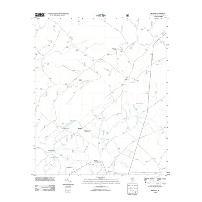
2011 Map of Bethera
USGS Topo · Published 2011About this map
Bethera and the surrounding Berkeley County landscape are defined by a complex network of waterways and managed lands. The area is anchored by the Little Hellhole Reserve and Midway Reserve, where features like the Little Hellhole Dam and Back Dam reflect local water management. Notable landmarks include the Witherbee Lookout Tower near Witherbee and the Boggy Head Rifle Range to the east. For genealogists and local historians, several burial grounds are identified, such as Berea Cemetery, Bethel Cemetery, and Reed Corner Cemetery. The map also traces the path of the Herberta Siding railroad spur and various creek crossings, including Nicholson Bridges and Gough Bridge. This era shows a transition in the use of the Lowcountry wetlands, with recreation and conservation sites like the Huger Recreation Area and Swamp Fox Trailhead integrated into the traditional settlement patterns of Limerick and Kensington.
Find a feature on this map
59 named features on this map. Tap any name to fly to it.
Don’t see what you’re looking for? This feature index may not catch every label — zoom into the map to look around manually.
Map Details
Editions of this 2011 Bethera Map
This is the sole edition of this map. No revisions or reprints were ever made.
Other maps of this area

1919 · Cordesville
USGS Topo · 1:48,000

1943 · Shulerville
USGS Topo · 1:24,000

1943 · Jamestown
USGS Topo · 1:24,000

1943 · Ocean Bay
USGS Topo · 1:24,000

1943 · Bonneau
USGS Topo · 1:62,500

1948 · Cordesville
USGS Topo · 1:24,000

1948 · Bethera
USGS Topo · 1:24,000
1949 · Cordesville
USGS Topo · 1:24,000

1949 · Georgetown
USGS Topo · 1:250,000
1950 · Huger
USGS Topo · 1:24,000