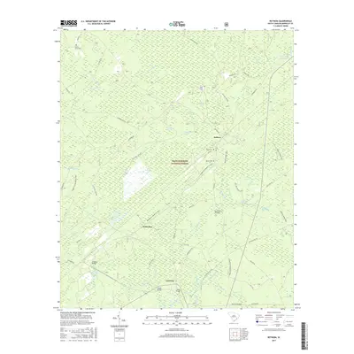
2017 Map of Bethera
USGS Topo · Published 2017About this map
The Francis Marion National Forest defines the character of this Berkeley County landscape, where dense swamp forests and low-lying bays dominate the geography. Within this protected wilderness, small settlements like Witherbee and Bethera serve as local anchors, connected by a network of rural roads such as Ackerman Rd and Little Hell Hole Rd. The terrain is defined by its unique depressions and drainages, including Little Hellhole Reserve, Jericho Swamp, and Peters Swamp. Genealogists and local historians can locate several rural burial grounds, such as Hickory Grove Cem and Reed Corner Cem, which are scattered among the timberlands. To the south, the waters of Huger Creek and Alligator Cr wind toward the larger river systems, crossed by landmarks like Alligator Bridge and Whitley Bridges, illustrating the water-dependent transit patterns of this coastal plain region.
Find a feature on this map
75 named features on this map. Tap any name to fly to it.
Don’t see what you’re looking for? This feature index may not catch every label — zoom into the map to look around manually.
Map Details
Editions of this 2017 Bethera Map
This is the sole edition of this map. No revisions or reprints were ever made.
Other maps of this area

1919 · Cordesville
USGS Topo · 1:48,000

1943 · Shulerville
USGS Topo · 1:24,000

1943 · Jamestown
USGS Topo · 1:24,000

1943 · Ocean Bay
USGS Topo · 1:24,000

1943 · Bonneau
USGS Topo · 1:62,500

1948 · Cordesville
USGS Topo · 1:24,000

1948 · Bethera
USGS Topo · 1:24,000
1949 · Cordesville
USGS Topo · 1:24,000

1949 · Georgetown
USGS Topo · 1:250,000
1950 · Huger
USGS Topo · 1:24,000