
1939 Map of Bethlehem
USGS Topo · Published 1939About this map
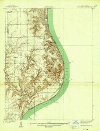
The Ohio River forms a dramatic eastern boundary for this portion of southern Indiana, as documented by topographic engineer Albert Pike and surveyor G. F. Westinghouse. The settlement of Bethlehem sits prominently on the riverbank, marking a transition between the fertile bottomlands and the dissected uplands of the interior. These interior plateaus are defined by a network of drainage systems like Fourteenmile Creek and Big Creek, where small rural communities like Otto, Marble Hill, and Paynesville are situated.
Find a feature on this map
27 named features on this map. Tap any name to fly to it.
Don’t see what you’re looking for? This feature index may not catch every label — zoom into the map to look around manually.
Map Details
Editions of this 1939 Bethlehem Map
2 editions found
Other maps of this area

1905 · Prospect
USGS Topo · 1:62,500

1912 · Prospect
USGS Topo · 1:62,500

1932 · La Grange
USGS Topo · 1:62,500

1938 · Owen
USGS Topo · 1:24,000

1939 · Madison West
USGS Topo · 1:24,000

1948 · Bethlehem
USGS Topo · 1:24,000

1948 · Madison West
USGS Topo · 1:24,000

1948 · Owen
USGS Topo · 1:24,000

1953 · Madison West
USGS Topo · 1:24,000

1953 · Bedford
USGS Topo · 1:24,000