
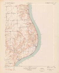
1948 Map of Bethlehem
USGS Topo · Published 1948About this map
The Ohio River forms a sweeping eastern boundary for this Indiana-Kentucky borderland, where the deeply carved valleys of Camp Creek and Big Saluda Cr meet the river's edge. This 1938 topography captures a landscape of small upland settlements and riverside outposts. Near the river bend, Bethlehem and Miles Point sit as distinct markers of the local river economy, while inland life centered around community nodes like Elizabeth Ch, Bethel Ch, and the Fairview Sch. Genealogists may find value in the detailed placement of the Turner Cem and Ross Cem, as well as the naming of rural hollows like Davidson Hollow and Hurricane Hol. The map clearly delineates the boundaries between Clark and Jefferson counties, illustrating how the drainage patterns of the limestone hills dictated the placement of early routes like Flint Ridge Road and the small hamlets of Otto and Paynesville.
Find a feature on this map
30 named features on this map. Tap any name to fly to it.
Don’t see what you’re looking for? This feature index may not catch every label — zoom into the map to look around manually.
Map Details
Editions of this 1948 Bethlehem Map
2 editions found
Other maps of this area

1905 · Prospect
USGS Topo · 1:62,500

1912 · Prospect
USGS Topo · 1:62,500

1932 · La Grange
USGS Topo · 1:62,500

1938 · Owen
USGS Topo · 1:24,000

1939 · Bethlehem
USGS Topo · 1:24,000

1939 · Madison West
USGS Topo · 1:24,000

1948 · Madison West
USGS Topo · 1:24,000

1948 · Owen
USGS Topo · 1:24,000

1953 · Madison West
USGS Topo · 1:24,000

1953 · Bedford
USGS Topo · 1:24,000