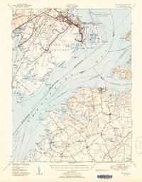
1951 Map of Betterton
USGS Topo · Published 1951About this map
The Aberdeen Proving Grounds dominates the western shoreline of the Chesapeake Bay, marking a landscape defined by its strategic military geography and deep-water access. This mid-century survey illustrates the distinct character of Stillpond Neck and Fairlee Neck on the Eastern Shore, where small communities like Still Pond and Melitota are connected by a network of rural roads and the Pennsylvania RR. The map captures the agricultural and maritime economy of the era, from the inland Fountain Church and St James Ch to the waterfront activity at Harris Wharf and Belcamp Beach.
Find a feature on this map
113 named features on this map. Tap any name to fly to it.
Don’t see what you’re looking for? This feature index may not catch every label — zoom into the map to look around manually.
Map Details
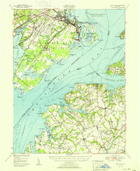
Editions of this 1951 Betterton Map
2 editions found
Other maps of this area

1893 · North Point
USGS Topo · 1:62,500

1893 · Gunpowder
USGS Topo · 1:62,500

1898 · Elkton
USGS Topo · 1:62,500

1898 · Tolchester
USGS Topo · 1:125,000

1899 · Dover
USGS Topo · 1:125,000

1900 · Elkton
USGS Topo · 1:62,500

1900 · Cecilton
USGS Topo · 1:62,500

1900 · Havre De Grace
USGS Topo · 1:62,500

1900 · Betterton
USGS Topo · 1:62,500

1901 · Belair
USGS Topo · 1:62,500