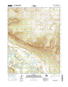
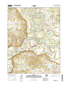
2016 Map of Bettles C-6 NE
USGS Topo · Published 2016About this map
The Alatna River meanders through the southwestern corner of this Yukon-Koyukuk landscape, defining a low-lying riparian corridor punctuated by Buzodoc Slough. This waterway contrast sharply with the rising elevation to the northeast, where the terrain ascends toward the prominent peak of Double Point Mtn. The transition from the river basin to the higher slopes reflects a typical interior Alaskan drainage pattern, where glacial or alluvial activity has carved out significant water bodies such as Dosennaughten Lake. Surveyed by the U.S. Geological Survey in 2016, the map documents a largely untouched wilderness within the Koyukuk region, capturing the complex network of unnamed streams and seasonal ponds that feed into the primary river system.
Find a feature on this map
8 named features on this map. Tap any name to fly to it.
Don’t see what you’re looking for? This feature index may not catch every label — zoom into the map to look around manually.
Map Details
Editions of this 2016 Bettles C-6 NE Map
This is the sole edition of this map. No revisions or reprints were ever made.
Other maps of this area

1951 · Bettles
USGS Topo · 1:250,000

1956 · Bettles
USGS Topo · 1:250,000
1970 · Bettles D-6
USGS Topo · 1:63,360
1970 · Bettles C-5
USGS Topo · 1:63,360
1970 · Bettles C-6
USGS Topo · 1:63,360
1970 · Bettles D-5
USGS Topo · 1:63,360
2016 · Bettles D-6 SW
USGS Topo · 1:25,000
2016 · Bettles C-5 NW
USGS Topo · 1:25,000
2016 · Bettles C-5 SW
USGS Topo · 1:25,000
2016 · Bettles C-6 SE
USGS Topo · 1:25,000