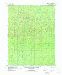
1970 Map of Bettles D-5
USGS Topo · Published 1973About this map
The Alatna Hills dominate this portion of the Alaskan interior, rising above a complex network of drainage basins. This 1970 survey, based on aerial photography from that year and annotated by the U.S. Geological Survey, documents the intricate meandering of the East Fork Henshaw Creek and the West Fork Henshaw Creek. The landscape is largely defined by water, including Fickett Creek and numerous unnamed small ponds and wetlands typical of this permafrost-influenced terrain. A notable terrestrial feature is the Winter Trail, which cuts across the southeastern corner of the quadrangle. This path signifies the essential seasonal transportation routes used in the Alaskan wilderness before more permanent infrastructure reached this area, reflecting a reliance on frozen ground and waterways for movement through the Yukon-Koyukuk region.
Find a feature on this map
5 named features on this map. Tap any name to fly to it.
Don’t see what you’re looking for? This feature index may not catch every label — zoom into the map to look around manually.
Map Details
Editions of this 1970 Bettles D-5 Map
2 editions found
Other maps of this area

1951 · Bettles
USGS Topo · 1:250,000

1951 · Wiseman
USGS Topo · 1:250,000

1956 · Bettles
USGS Topo · 1:250,000

1956 · Wiseman
USGS Topo · 1:250,000

1964 · Wiseman
USGS Topo · 1:250,000

1970 · Bettles D-4
USGS Topo · 1:63,360
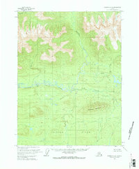
1970 · Wiseman A-6
USGS Topo · 1:63,360

1970 · Wiseman A-4
USGS Topo · 1:63,360

1970 · Bettles C-4
USGS Topo · 1:63,360
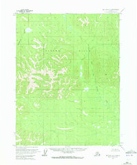
1970 · Bettles D-6
USGS Topo · 1:63,360