
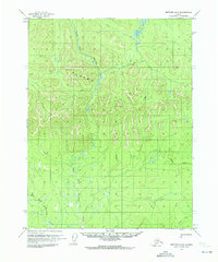
1970 Map of Wiseman A-4
USGS Topo · Published 1973About this map
The John River meanders through this interior Alaska landscape, defining a wide valley corridor flanked by prominent summits like Threetime Mountain and Button Mountain. This 1970 survey captures the remote character of the region, where seasonal transport is marked by the presence of a Winter Road and a Winter Trail cutting across the lowlands of Death Valley. Human presence is sparse, indicated only by small structures such as Ninemile Cabin near the shores of Ninemile Lake and another isolated Cabin further north. The drainage patterns of Timber Creek and Death Valley Creek emphasize the hydraulic complexity of the terrain as it transitions from the high peaks of Gilroy Mountain down toward Goose Slough. These markings reflect an era of Alaskan history centered on subsistence and seasonal access before more permanent infrastructure reached this part of the Yukon-Koyukuk region.
Find a feature on this map
15 named features on this map. Tap any name to fly to it.
Don’t see what you’re looking for? This feature index may not catch every label — zoom into the map to look around manually.
Map Details
Editions of this 1970 Wiseman A-4 Map
This is the sole edition of this map. No revisions or reprints were ever made.
Other maps of this area

1951 · Bettles
USGS Topo · 1:250,000

1951 · Wiseman
USGS Topo · 1:250,000

1956 · Bettles
USGS Topo · 1:250,000

1956 · Wiseman
USGS Topo · 1:250,000

1964 · Wiseman
USGS Topo · 1:250,000

1970 · Bettles D-4
USGS Topo · 1:63,360

1970 · Wiseman A-3
USGS Topo · 1:63,360

1970 · Bettles D-3
USGS Topo · 1:63,360

1970 · Wiseman A-5
USGS Topo · 1:63,360
1970 · Bettles D-5
USGS Topo · 1:63,360