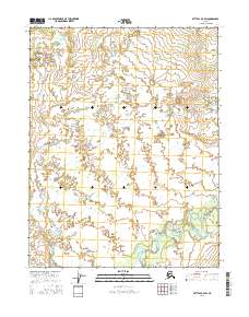
2016 Map of Bettles D-3 SW
USGS Topo · Published 2016About this map
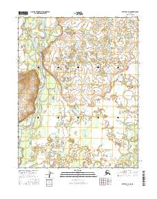
South Fork Koyukuk River dominates the southeastern quadrant of this Interior Alaska landscape, winding through a complex network of wetlands and oxbow lakes. The terrain is defined by the Public Land Survey System grids of t24n r18w, t24n r17w, and surrounding townships, illustrating the vast, unpopulated character of the Yukon-Koyukuk region. In this section of the subarctic, the hydrological patterns of the river valley contrast sharply with the higher elevation contours to the north, providing a clear record of the area's natural drainage before any significant human development. The map serves as a primary source for understanding the pristine state of these waterways and the formal land divisions established by the Bureau of Land Management.
Find a feature on this map
7 named features on this map. Tap any name to fly to it.
Don’t see what you’re looking for? This feature index may not catch every label — zoom into the map to look around manually.
Map Details
Editions of this 2016 Bettles D-3 SW Map
This is the sole edition of this map. No revisions or reprints were ever made.
Other maps of this area

1951 · Bettles
USGS Topo · 1:250,000

1956 · Bettles
USGS Topo · 1:250,000

1970 · Bettles D-4
USGS Topo · 1:63,360

1970 · Bettles C-4
USGS Topo · 1:63,360

1970 · Bettles D-3
USGS Topo · 1:63,360
1970 · Bettles C-3
USGS Topo · 1:63,360
2016 · Bettles C-3 NW
USGS Topo · 1:25,000
2016 · Bettles C-3 NE
USGS Topo · 1:25,000
2016 · Bettles C-4 NE
USGS Topo · 1:25,000
2016 · Bettles D-4 NE
USGS Topo · 1:25,000