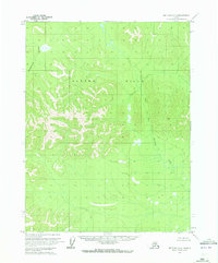
1970 Map of Bettles D-6
USGS Topo · Published 1973About this map
Alatna Hills dominate the central landscape of this interior Alaska region, marking a significant topographic rise between major drainages. The area is defined by its complex hydrological network, where the West Fork Henshaw Creek meanders through the eastern lowlands, mirrored by the drainage of Rockybottom Creek to the northwest. This 1970 aerial survey, later published by the Geological Survey, reveals a wilderness largely devoid of permanent human infrastructure, characterized instead by the predetermined but unsurveyed land lines established by the Bureau of Land Management. The map focuses on the elevation and drainage patterns of the Koyukuk region before any modern industrial or transport development altered the character of these remote hills.
Find a feature on this map
6 named features on this map. Tap any name to fly to it.
Don’t see what you’re looking for? This feature index may not catch every label — zoom into the map to look around manually.
Map Details
Editions of this 1970 Bettles D-6 Map
This is the sole edition of this map. No revisions or reprints were ever made.
Other maps of this area

1951 · Hughes
USGS Topo · 1:250,000

1951 · Bettles
USGS Topo · 1:250,000

1951 · Survey Pass
USGS Topo · 1:250,000

1951 · Wiseman
USGS Topo · 1:250,000

1956 · Hughes
USGS Topo · 1:250,000

1956 · Bettles
USGS Topo · 1:250,000

1956 · Wiseman
USGS Topo · 1:250,000

1956 · Survey Pass
USGS Topo · 1:250,000

1964 · Survey Pass
USGS Topo · 1:250,000

1964 · Wiseman
USGS Topo · 1:250,000