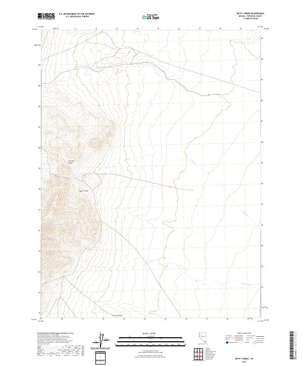
2021 Map of Betty Creek
USGS Topo · Published 2021About this map
Selenite Range dominates the western half of this Nevada landscape, where its steep ridges and canyons transition into the broad, open basin of the Kumiva Valley. This arid terrain is defined by its vital water sources, including the secluded Lookout Spring and Redwood Spring, which served as critical landmarks for travelers and surveyors navigating the Pershing County desert. The drainage system reveals a distinct eastward flow toward the valley floor, with ephemeral waters like Little Meadow Cr and Betty Cr cutting through the complex topography. The absence of modern development highlights the primitive nature of the terrain, where Missouri Cr and Desert Spring remain some of the few named landmarks in a region largely defined by its natural landforms and early township and range survey lines.
Find a feature on this map
14 named features on this map. Tap any name to fly to it.
Don’t see what you’re looking for? This feature index may not catch every label — zoom into the map to look around manually.
Map Details
Editions of this 2021 Betty Creek Map
This is the sole edition of this map. No revisions or reprints were ever made.
Other maps of this area

1886 · Granite Range
USGS Topo · 1:250,000

1894 · Granite Range
USGS Topo · 1:250,000

1955 · Lovelock
USGS Topo · 1:250,000

1959 · Lovelock
USGS Topo · 1:250,000

1964 · Gerlach
USGS Topo · 1:62,500

1964 · Kumiva Peak
USGS Topo · 1:62,500

1980 · Eagle Rock Spring
USGS Topo · 1:24,000

1980 · Tenmile
USGS Topo · 1:24,000

1981 · Twin Buttes Well
USGS Topo · 1:24,000

1981 · Gerlach
USGS Topo · 1:100,000