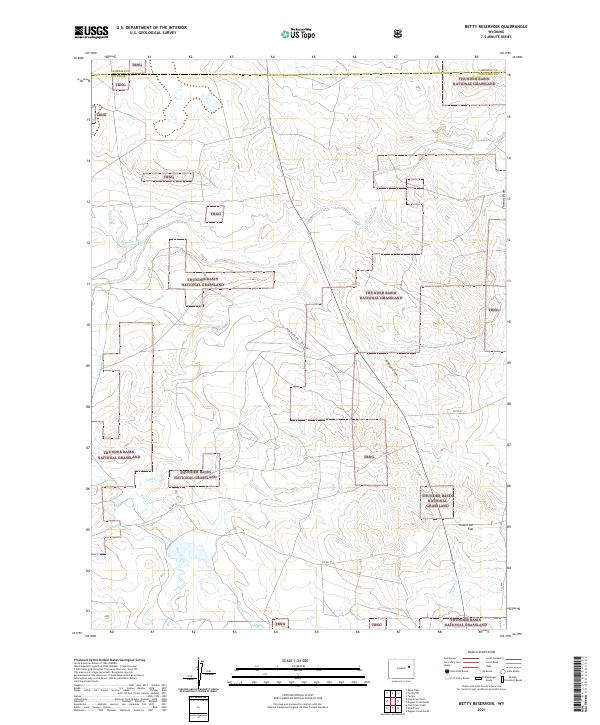
2021 Map of Betty Reservoir
USGS Topo · Published 2021About this map
Thunder Basin National Grassland dominates this high plains landscape on the border of Campbell and Converse Counties. The map reveals an intricate network of seasonal drainages and named coulees, including Haefele Draw and Johnson Draw, which carve through the shortgrass prairie. In the southwest corner, the Betty-Supply Ditch reflects the area's historical reliance on water engineering to support agriculture and livestock in a semi-arid environment. This topographic record documents a region where the vast public lands of the Tbng intermingle with private holdings. Local landmarks like Robertson Flat provide a sense of the level terrain that characterizes this portion of Wyoming, while watercourses such as Antelope Cr and Bates Creek serve as primary geographical anchors for the area.
Find a feature on this map
24 named features on this map. Tap any name to fly to it.
Don’t see what you’re looking for? This feature index may not catch every label — zoom into the map to look around manually.
Map Details
Editions of this 2021 Betty Reservoir Map
This is the sole edition of this map. No revisions or reprints were ever made.
Other maps of this area

1955 · Newcastle
USGS Topo · 1:250,000

1958 · Newcastle
USGS Topo · 1:250,000

1959 · Betty Reservoir
USGS Topo · 1:62,500

1959 · Coal Draw
USGS Topo · 1:62,500

1960 · Turnercrest
USGS Topo · 1:62,500

1971 · Teckla
USGS Topo · 1:24,000

1971 · Teckla SW
USGS Topo · 1:24,000

1974 · Reno Junction
USGS Topo · 1:100,000

1979 · Bill
USGS Topo · 1:100,000
1984 · Dugout Creek North
USGS Topo · 1:24,000