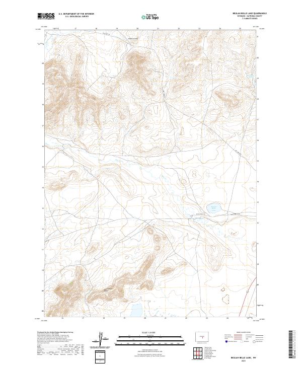
2021 Map of Beulah Belle Lake
USGS Topo · Published 2021About this map
Sweetwater Rocks anchor the southern landscape of this high plains region, where the terrain is defined by dramatic elevation changes and intermittent water sources. The namesake Beulah Belle Lake sits in the eastern reaches, serving as a vital landmark in an area otherwise characterized by long draws and seasonal drainages like Dry Cr. This 2021 survey illustrates a sparse ranching landscape, where the human footprint is primarily limited to essential access routes such as Buelah Belle Rd and Rossa Ranch Rd. To the north, Roberts Draw cuts through the ridges, while Black Rock Springs provides a rare point of permanent water in the northeastern corner. The map traces the intersection of natural topography and remote rural infrastructure, marking the vast township boundaries that structure this portion of Natrona County.
Find a feature on this map
14 named features on this map. Tap any name to fly to it.
Don’t see what you’re looking for? This feature index may not catch every label — zoom into the map to look around manually.
Map Details
Editions of this 2021 Beulah Belle Lake Map
This is the sole edition of this map. No revisions or reprints were ever made.
Other maps of this area

1951 · Savage Peak
USGS Topo · 1:24,000

1951 · Independence Rock
USGS Topo · 1:24,000

1951 · Fort Ridge
USGS Topo · 1:24,000

1955 · Casper
USGS Topo · 1:250,000

1958 · Casper
USGS Topo · 1:250,000

1959 · Horse Creek Springs
USGS Topo · 1:24,000

1959 · Sanford Ranch
USGS Topo · 1:24,000

1959 · Saddle Rock
USGS Topo · 1:24,000

1959 · Miller Spring
USGS Topo · 1:24,000

1959 · Barlow Gap
USGS Topo · 1:24,000