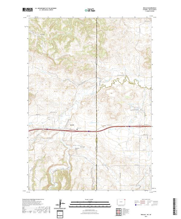
2021 Map of Beulah
USGS Topo · Published 2021About this map
Beulah sits at a critical intersection of hydrology and geography where Redwater Cr and Sand Cr converge. This 2021 survey shows how the landscape is divided by the Wyoming and South Dakota border, a line that cuts through the drainage basins of the Black Hills foothills. The settlement is centered along the historic corridor of Old US Hwy 14, now paralleled by the modern transit of I-90. Just east of the town center, the Beulah Cem marks a point of local genealogical interest, while the surrounding terrain transitions from the broken draws of The Brakes to the managed waters of Montana Lake and the Miller Ditch. Further south, the map details the rugged relief of Bear Gulch and Shepherd Gulch, providing a clear view of the ranch roads and water systems that define this borderland community.
Find a feature on this map
53 named features on this map. Tap any name to fly to it.
Don’t see what you’re looking for? This feature index may not catch every label — zoom into the map to look around manually.
Map Details
Editions of this 2021 Beulah Map
This is the sole edition of this map. No revisions or reprints were ever made.
Other maps of this area

1894 · Deadwood
USGS Topo · 1:125,000

1898 · Sundance
USGS Topo · 1:125,000

1900 · Spearfish
USGS Topo · 1:62,500

1901 · Deadwood
USGS Topo · 1:125,000

1901 · Aladdin
USGS Topo · 1:125,000

1902 · Sundance
USGS Topo · 1:125,000

1903 · Aladdin
USGS Topo · 1:125,000

1907 · Belle Fourche
USGS Topo · 1:125,000

1907 · Redwater
USGS Topo · 1:62,500

1915 · Spearfish
USGS Topo · 1:62,500