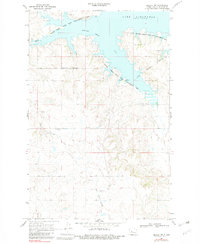
1969 Map of Beulah NW
USGS Topo · Published 1983About this map
Lake Sakakawea dominates the northern landscape of this Mercer County region, its irregular shoreline carving deep into the prairie. The map documents the northern edge of the Fort Berthold Indian Reservation Boundary, illustrating the intersection of tribal lands and state-managed territory such as the Beaver Creek State Game Management Area. This confluence of jurisdictions reflects the complex land management patterns common in mid-century North Dakota.
Find a feature on this map
12 named features on this map. Tap any name to fly to it.
Don’t see what you’re looking for? This feature index may not catch every label — zoom into the map to look around manually.
Map Details
Editions of this 1969 Beulah NW Map
2 editions found
Other maps of this area

1953 · Watford City
USGS Topo · 1:250,000

1954 · McClusky
USGS Topo · 1:250,000

1957 · Watford City
USGS Topo · 1:250,000

1958 · McClusky
USGS Topo · 1:250,000

1967 · Watford City
USGS Topo · 1:250,000

1967 · Blackwater Lake SE
USGS Topo · 1:24,000

1967 · Raub SE
USGS Topo · 1:24,000

1967 · Blackwater Lake SW
USGS Topo · 1:24,000

1968 · Beulah
USGS Topo · 1:24,000

1969 · Beulah NE
USGS Topo · 1:24,000